The honeycomb Tube
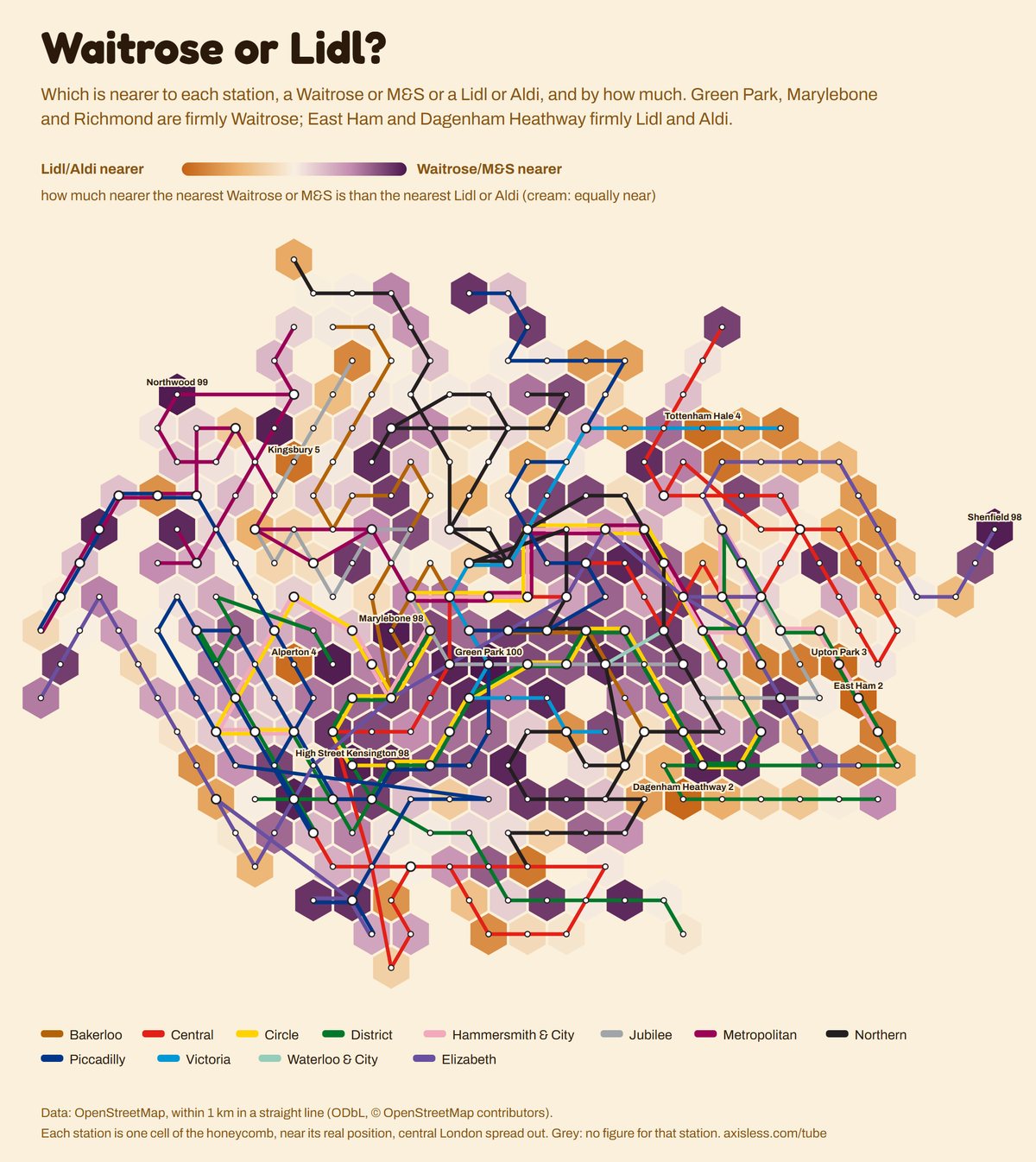
Every Tube and Elizabeth line station as one cell of a honeycomb, near where it really is, with the lines running through. Over eighty layers colour it: when people travel, how deep the platforms are, the nearest Greggs and whether Waitrose or Lidl is closer, who lives nearby, what homes cost, and more.
More maps
All 82 maps
Travel 17
Food & drink 25
People 15
Homes & money 8
Place 17
Hover or tap a station for its number. On a phone, swipe the map sideways.
Download this map as an image · The layout code is open source on GitHub
Data sources
Data: TfL station entry and exit counts, 2025: a typical Monday, Tuesday to Thursday, Friday, Saturday and Sunday for the Underground and the Elizabeth line (Bank and Monument are counted together; Kensington (Olympia) is counted under the Overground). Powered by TfL Open Data. House prices: HM Land Registry Price Paid Data, standard home sales 2024-25 in the postcode sector nearest each station (contains HM Land Registry data © Crown copyright and database right 2026, OGL v3.0). Opening years: Wikidata (CC0). Pubs, cafes, the nearest Greggs, Pret and Wetherspoon, blue plaques and green space: OpenStreetMap (ODbL, © OpenStreetMap contributors), within 1 km in a straight line. No car, born abroad, degrees, homeowners, median age and walking or cycling to work: Census 2021 (ONS, OGL), the neighbourhood (MSOA) around each station. Depth: Transport for London, FOI-0493-2223 (2022), Underground platforms only. Height: EU-DEM, produced using Copernicus data and information funded by the European Union. Food hygiene: Food Standards Agency ratings (OGL). Minutes to Oxford Circus: TfL Journey Planner, a Wednesday at 10am. Late nights, the evening rush and changing trains: TfL NUMBAT 2025. Bus routes and Santander bikes: TfL APIs. Chains, gyms, chicken shops and supermarkets: OpenStreetMap. Flats, living alone, overcrowding, students and density: Census 2021. Household income: ONS small-area income estimates, 2022-23 (OGL). Air pollution: London Atmospheric Emissions Inventory 2022 (GLA). Street trees: GLA London Public Realm Trees, 2025. Listed buildings: Historic England (OGL; contains Historic England data © Historic England 2026, contains OS data © Crown copyright and database right 2026). Airbnbs: Inside Airbnb, June 2026 (CC BY 4.0). Price rise since 2000: HM Land Registry, not adjusted for inflation. Wikipedia views: Wikimedia. Line routes from the TfL Unified API. Each station is one honeycomb cell, placed near its real position with central London spread out; like every Tube map, it bends geography where it has to.
The Tube, by the numbers · Play Tube Imposter · All visualisations