Monopoly, priced for real
Every street on the Monopoly board, priced from what homes on the real street sell for today. The London board, and the original American one, named after Atlantic City.
The board, coloured by real prices
The board's order against the real order
In today's money
Was it ever right?
Before the game: was the board ever right?
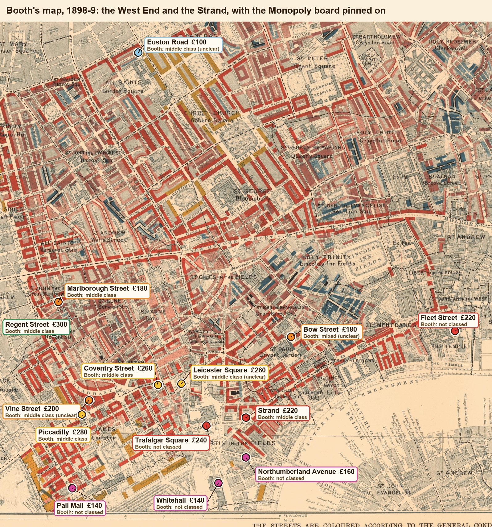
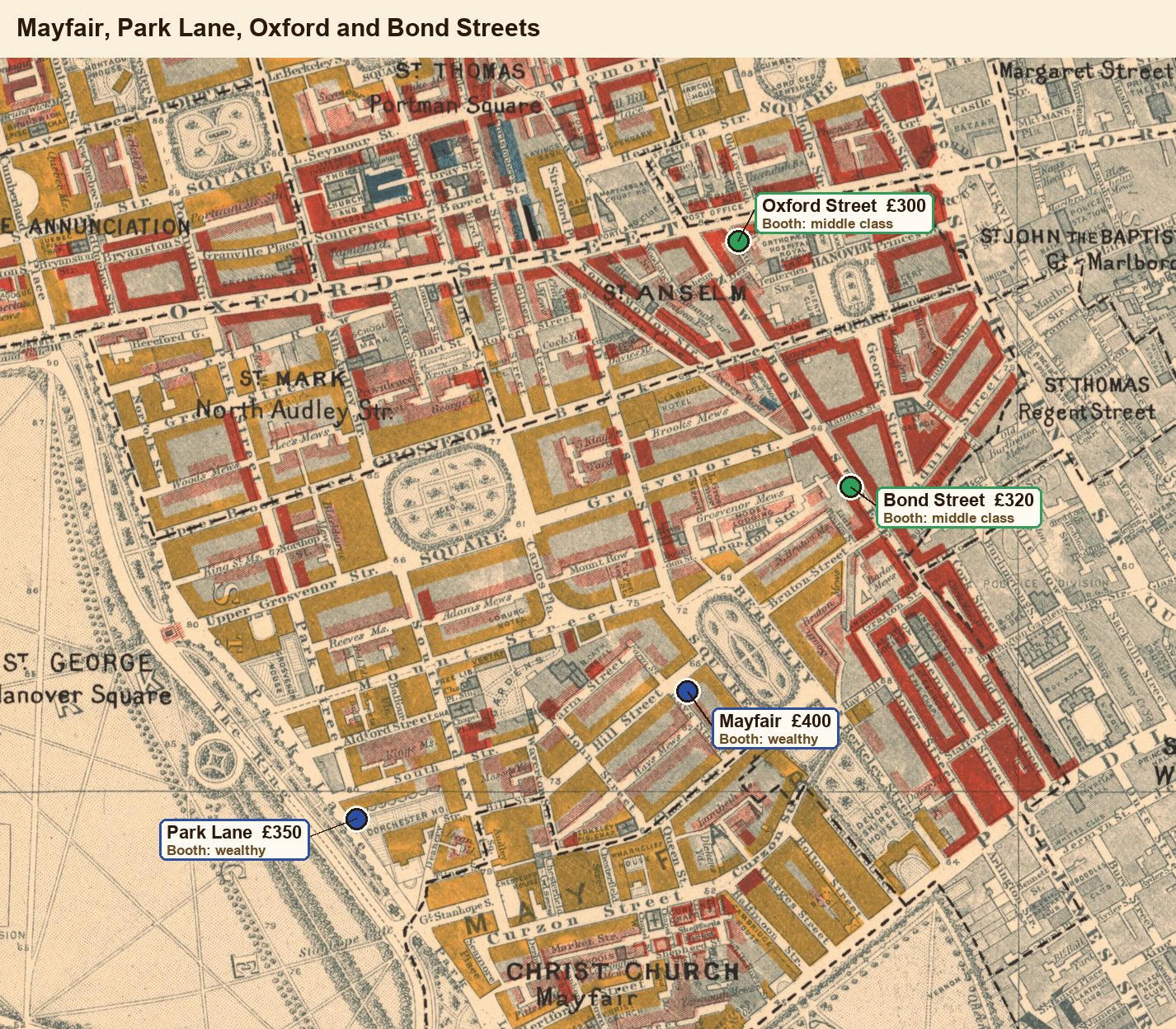
A generation before Monopoly, Charles Booth sent investigators down every street in London and coloured each one by the people living on it, from black ("lowest class") to yellow ("wealthy"). We went back to his map and read off every street on the board. The map: Map Descriptive of London Poverty, 1898–9, scanned by LSE Library for Charles Booth's London (public domain).
Finding
The evidence board · four cases: tap each tab
Drag anything · pull the string · tab to a card and use the arrow keys
Exhibits
Evidence index
Case notes: how we read a 125-year-old map
1. The map. Booth's Map Descriptive of London Poverty, 1898–9 survives as twelve printed sheets, scanned by LSE Library and free to reuse. Each scan is up to 11,000 pixels across.
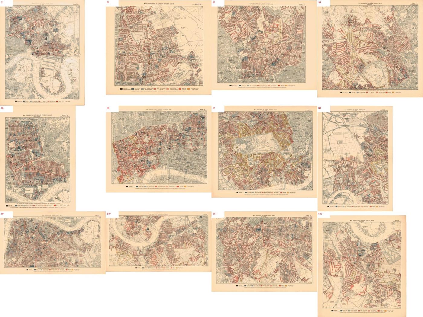
2. The key. Seven colours, printed at the foot of every sheet. Streets of offices, clubs, hotels and ministries are left uncoloured: Booth only classed the people who lived there.

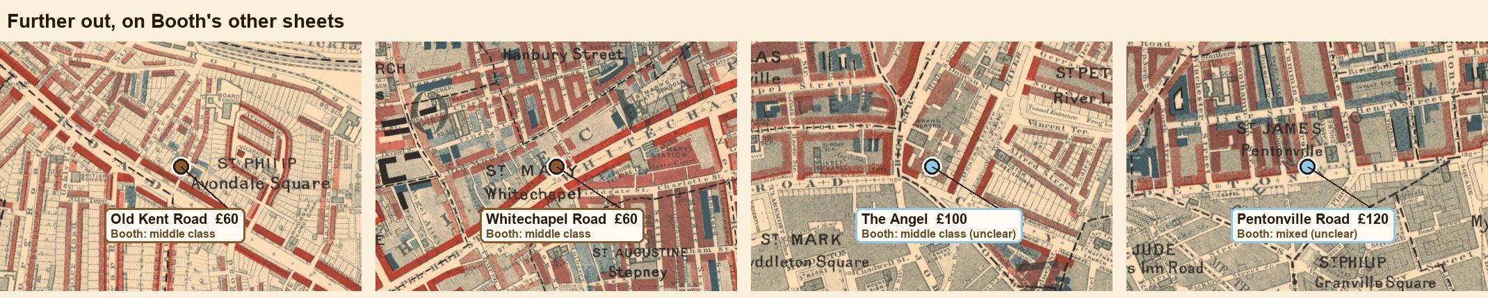
3. The reading. Each street found on its sheet, pinned, and its colour read from a close-up. A street that is tiny, split between colours or hard to pick out is marked unclear. Every close-up is below.
4. What didn't work. We first had a script match pixels to the key. Up close the map is printed as fine hatching, not flat colour, and the colours drift from sheet to sheet: the machine read the white road surface, and counted the dark strokes of unclassed buildings as "very poor". So the readings are by eye, with the evidence on show.

Six of the 22 are marked unclear. Check them yourself: the close-ups are below.
Close-ups, one per street
Atlantic City turned inside out
London's rich have stayed put for 125 years. Atlantic City's moved.
Verdict
In 1930, five years before the game, the beach was the prize: homes on the Boardwalk rented for about $200 a month, against $30 to $80 on the other Monopoly streets. Today the Boardwalk is casinos and condo towers selling for a middling $159,000, and the most expensive homes on the board are out of town. The board was drawn for the city Atlantic City was.
Only 5 Boardwalk households are in the 1930 sample. Strong direction, shaky number.
Case: the impostor avenue
The most expensive street on the board, Marvin Gardens, isn't in Atlantic City at all. It is Marven Gardens, a neighbourhood of big family houses on the Margate–Ventnor line, where homes sell for about $715,000. The game's makers spelled it wrong, and the spelling stuck.
Case: the vanished street
St. Charles Place had 11 households in the 1930 census sample. The city gave up the street in 1968, and its site went to the Showboat casino, which opened in 1987. Illinois Avenue is still there, renamed Martin Luther King Jr. Boulevard.
Case: why London looks more right
Partly it is. But London's check rests on thousands of home sales; Atlantic City's 1930 check rests on 9 streets and 5 to 36 renting households each, and compares rents then with prices now. Read the 1930 match as a hint, not a verdict.